Revolutionizing Road Maintenance: Our Pothole Detection Solution Using Satellite and Aerial Imagery
We are building a cutting-edge solution to tackle one of the most persistent issues in road infrastructure—potholes. Traditional detection methods are slow, expensive, and limited in scope. That’s why we’re leveraging high-resolution satellite and aerial imagery combined with AI to detect potholes accurately and at scale.
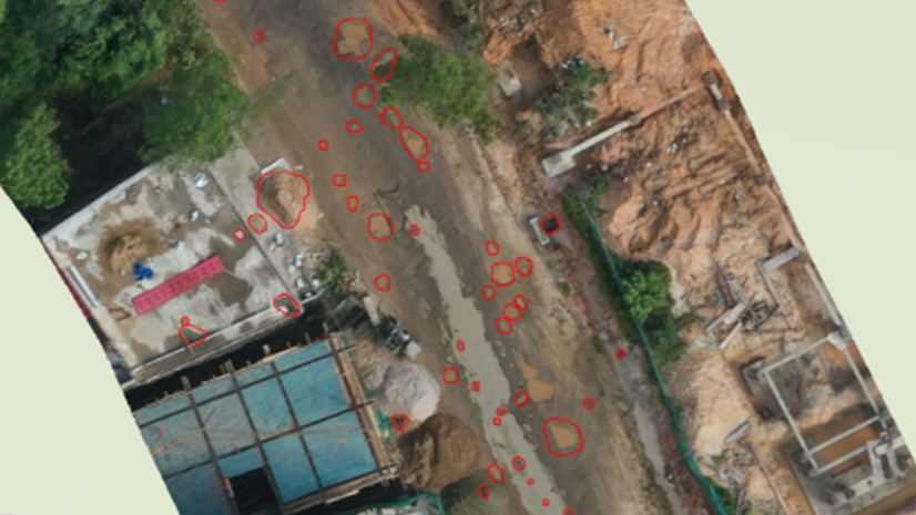
Our platform uses advanced image processing and machine learning models to analyze road surfaces from above, identifying potholes based on unique visual patterns such as cracks, shadows, and surface deformations. These models are trained to differentiate potholes from other visual noise, ensuring high accuracy across diverse environments.
What sets our solution apart is its ability to monitor vast areas quickly and cost-effectively. City planners, municipalities, and transportation departments can gain real-time insights into road conditions, prioritize repairs, and allocate resources more efficiently.
Smarter infrastructure management
We’re not just automating detection—we’re enabling smarter infrastructure management. By integrating satellite and drone data with powerful analytics, we’re helping build safer, more resilient road networks.
We are proud to be shaping the future of intelligent road maintenance.